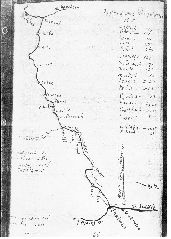
Dan Brown contributed the map below. He writes, "The hand drawn map of former lumber towns and population was apparently drawn by Coy Brown. I don't know when or how he gathered the data or how accurate it is." The camps shown were located in eastern Pacific county and western Lewis county.
